Swisstopo
Mixed Reality Experience at GeodataLab Bern
swisstopo
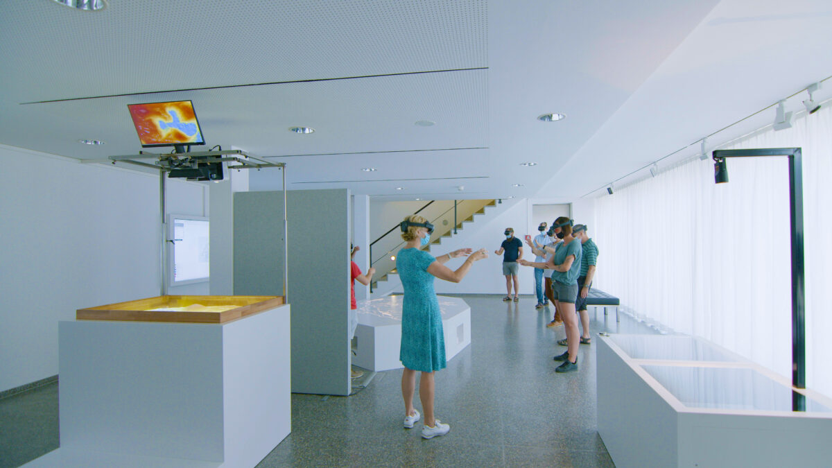
The Federal Office of Topography swisstopo surveys Switzerland, records and documents the landscape and the subsoil and shows their changes over time. The product range is broad: In addition to the familiar national maps on paper, it also includes altitude and landscape models, aerial photographs, orthophotos, geological data and applications on the Internet and smartphones. To make the digital geodata accessible in a completely new way, the so-called GeodataLab was conceived at the headquarters in Wabern near Bern. With the help of augmented reality, visitors can experience five subject areas in 3D.
In Kürze
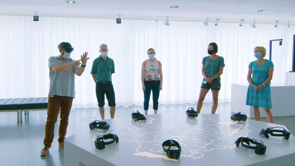
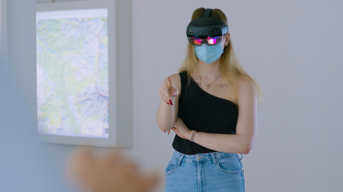
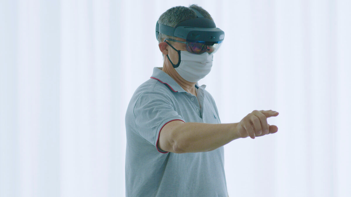
- Mixed Reality with eight Holo Lenses
- Five thematic areas on the topography of Switzerland
- Cross-referencing of current and historical maps
- Live streams from Mixed Reality glasses on two screens
- Access to federal map viewer
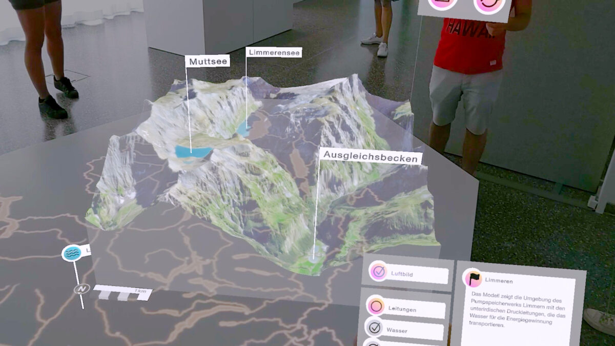
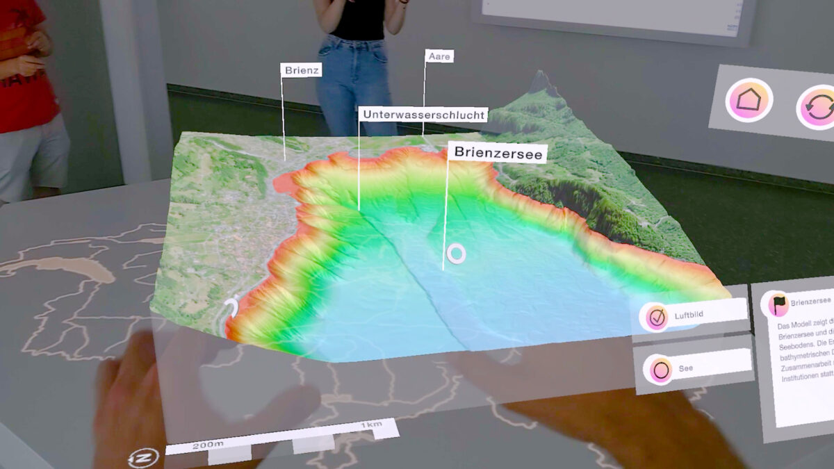
Virtual Maps in 3D
The centrepiece of the GeodataLab is a polygonal cuboid made of white Corian. In the space above, with the help of augmented reality glasses - so-called HoloLenses - the familiar maps and geodata of Switzerland can be experienced in a brand new way. A total of eight visitors can interact at the same time. They learn, among other things, how two-dimensional maps work in three-dimensional space, what effects the construction of a dam has on the landscape, what it looks like underground and in lakes, and how building regulations can be depicted. The different information levels can be selected and deselected at any time and the three-dimensional models can be positioned in space with simple gestures so that one has the best possible overview.
Outlook
The applications developed for swisstopo show in an exemplary way that augmented reality has great potential for exhibitions. Not only are AR glasses now lightweight design objects, but the presentation and interaction possibilities are lighter and more visually attractive than ever. Since everyone can interact with the data with two hands, it can literally be grasped more easily. The spatial reference inherent in geodata can thus be experienced in a whole new way.
Opening
2021
Location
Bern
Client
swisstopo – Bundesamt für Landestopografie
Partners
kläusler acrylstein agikonaut GmbHKilchenmann AG
Services
Project ManagementProject ControllingExtended Reality DesignService and SupportProcess Design and ManagementArchitectural and Spatial DesignExperiential DesignSoftware Engineering